

3D terrain models
Real landscapes to turn, zoom and re-skin, built from national LiDAR elevation data at true vertical scale. Each one can be embedded in Notion or Google Sites.
19 models, grouped by landscape
Glaciers
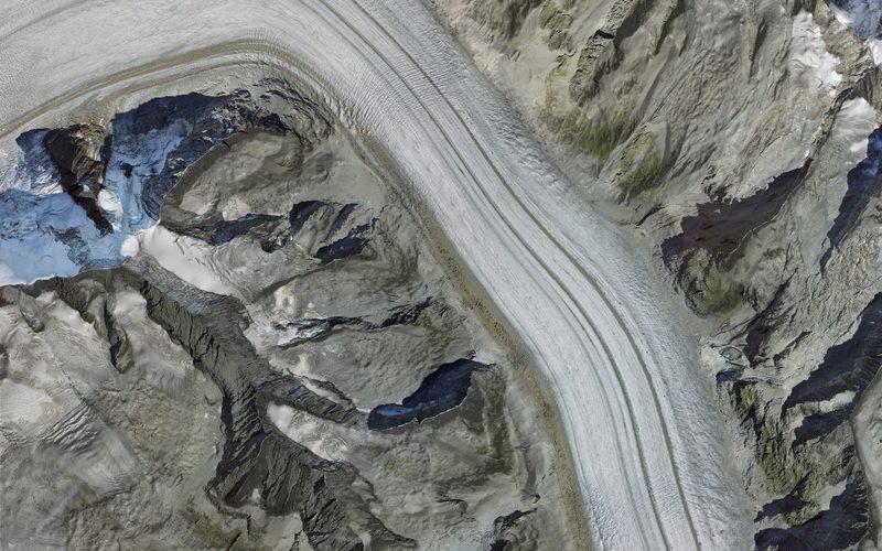
SwitzerlandValais, Switzerland
Great Aletsch Glacier
The largest glacier in the Alps, from the ice streams that meet at Konkordiaplatz down past the Eggishorn. Where two streams join, their lateral moraines merge into one medial moraine: the dark stripes that run down the ice.
Option C: Extreme environments
7 × 11 km · 2,011 to 3,906 m
QualityA large area, so less detail close up.Open the model
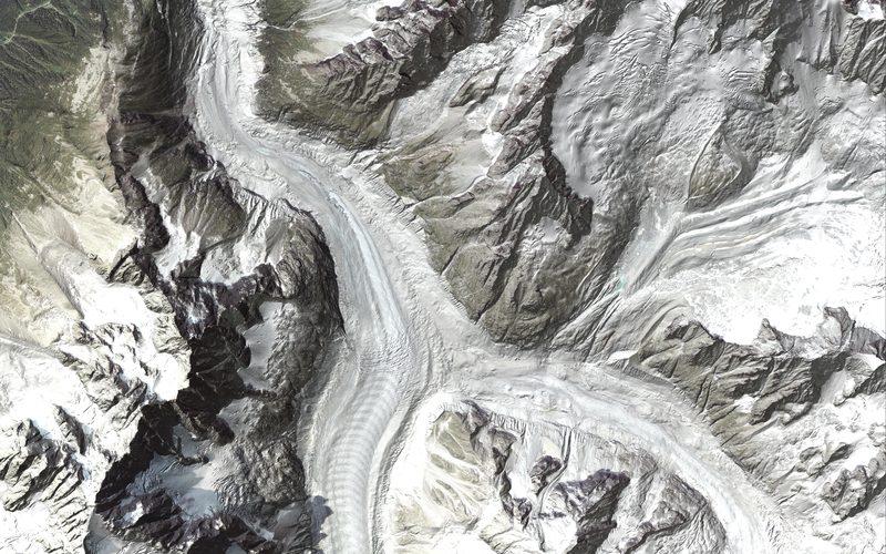
FranceMont-Blanc massif, France
Mer de Glace
The whole of France's largest glacier: from the Géant icefall and the Leschaux and Talèfre glaciers down to its snout below Montenvers, between the Aiguilles de Chamonix and the Aiguille Verte.
Option C: Extreme environments
8 × 8 km · 928 to 4,120 m
QualityA large area, so less detail close up.Open the model
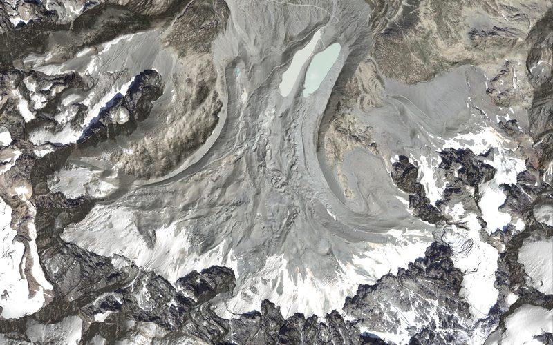
FranceÉcrins massif, French Alps
Glacier d'Arsine
A debris-covered cirque glacier under the north faces of the Pic de Neige Cordier and the Montagne des Agneaux, with the lake held behind its moraine and the Col d'Arsine beyond.
Option C: Extreme environments
4 × 4 km · 2,160 to 3,664 m
QualityFine elevation survey and a clear aerial photo.Open the model
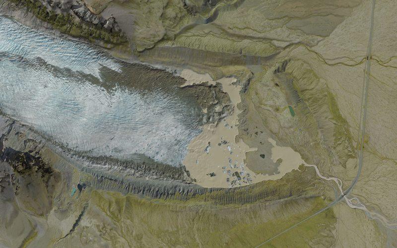
IcelandÖræfajökull, south-east Iceland
Kvíárjökull
An outlet glacier of Öræfajökull spilling into a horseshoe of moraine: lateral ridges more than 100 metres high either side of the tongue, closed by a terminal moraine the meltwater river has cut through.
Option C: Extreme environments
5 × 5 km · 0 to 902 m
QualityFine elevation survey and a clear aerial photo.Open the model
Landforms the ice left
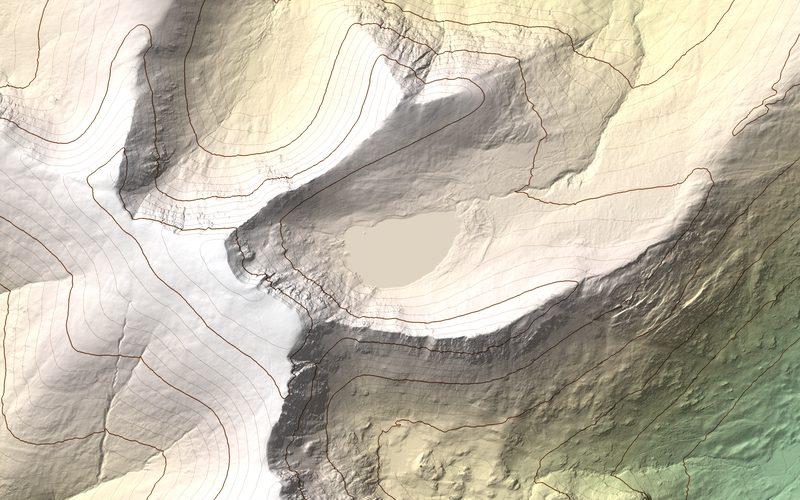
EnglandLake District, England
Red Tarn, Helvellyn
A textbook corrie: Red Tarn in its rock basin under the steep back wall of Helvellyn, held in by a lip, with the arêtes of Striding Edge and Swirral Edge on either side.
Option C: Extreme environments
3 × 3 km · 217 to 950 m
QualityNo aerial photo is available here.Open the model
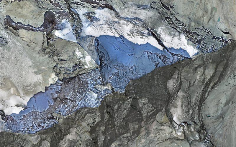
SwitzerlandValais, Switzerland, on the Italian border
Matterhorn
The textbook pyramidal peak: four faces cut back by glaciers on every side until only a horn and its ridges were left, with the Hörnli ridge running down towards Zermatt.
Option C: Extreme environments
4 × 4 km · 2,267 to 4,477 m
QualityPart of the aerial photo is in shadow.Open the model
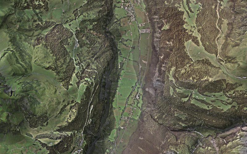
SwitzerlandBernese Oberland, Switzerland
Lauterbrunnen valley
A textbook glacial trough, or U-shaped valley: a flat floor between near-vertical walls, with Mürren and Wengen on the shoulders above and waterfalls such as the Staubbach dropping from hanging valleys.
Option C: Extreme environments
5 × 7.8 km · 727 to 3,406 m
QualityPart of the aerial photo is in shadow.Open the model
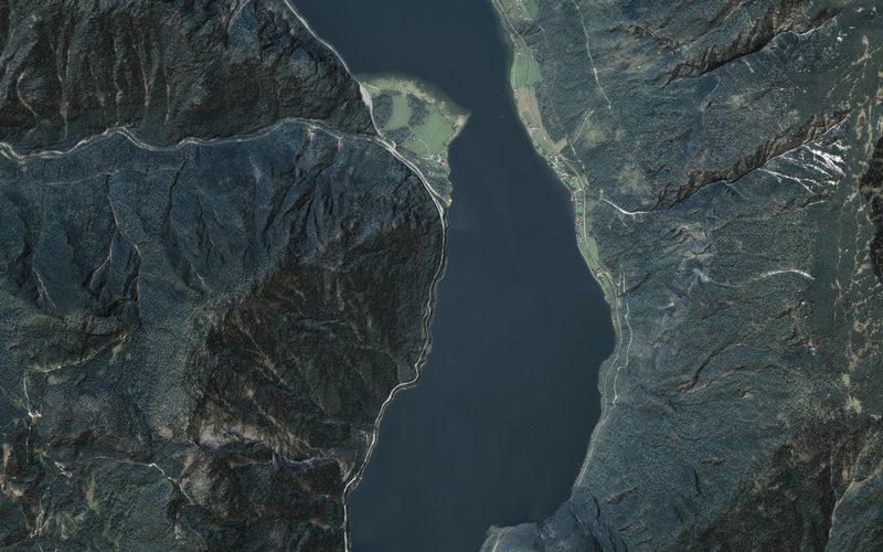
AustriaSalzkammergut, Austria
Hallstätter See
A ribbon lake: long, narrow and deep, filling a glacial trough between steep limestone walls, with Hallstatt squeezed onto the shore and the Traun's delta growing into its southern end.
Option C: Extreme environments
5.5 × 7.8 km · 504 to 1,880 m
QualityFine elevation survey and a clear aerial photo.Open the model
Periglacial ground
SvalbardSpitsbergen, Svalbard
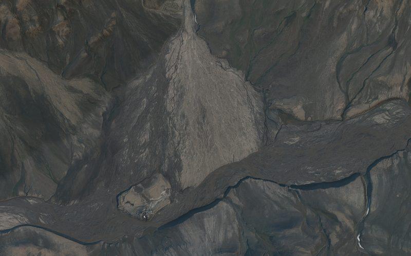
Innerhytta pingo, Adventdalen
A pingo, an ice-cored mound pushed up through permafrost, standing in the braided bed of the Adventelva where a side valley's fan meets the main valley.
Option C: Extreme environments
3 × 3 km · 57 to 510 m
QualityThe aerial photo is dark in this part of the valley.Open the model
SvalbardSpitsbergen, Svalbard
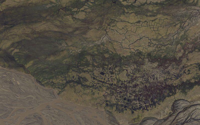
Ice-wedge polygons, Adventdalen
Patterned ground on a terrace beside the Adventelva: a net of cracks marks the ice wedges in the permafrost below, and where the polygon centres have sunk they hold ponds.
Option C: Extreme environments
1.2 × 1.2 km · 8 to 31 m
QualityFine elevation survey and a clear aerial photo.Open the model
Hot, arid landscapes
USANavajo Nation, Arizona and Utah, USA
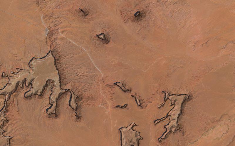
Monument Valley
The buttes and mesas of Monument Valley Navajo Tribal Park: the Mittens and Merrick Butte, Mitchell Mesa to the west and Sentinel Mesa to the north, and Rain God Mesa and the Three Sisters along the valley drive.
Option C: Extreme environments
10 × 10 km · 1,492 to 2,007 m
QualityMost of the area has only 10 m elevation data; a large area, so less detail close up.Open the model
SpainAlmería, Spain
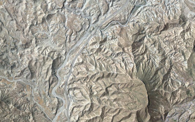
Ramblas of the Tabernas Desert
Dry river channels in Europe's driest corner: wide, flat-floored ramblas that carry water only after rare storms, cut into soft badlands. A rambla is the Spanish equivalent of a wadi.
Option C: Extreme environments
5 × 5.5 km · 166 to 740 m
QualityThe elevation survey is 5 m, so fine relief is soft.Open the model
Rivers
IcelandSouth coast, Iceland
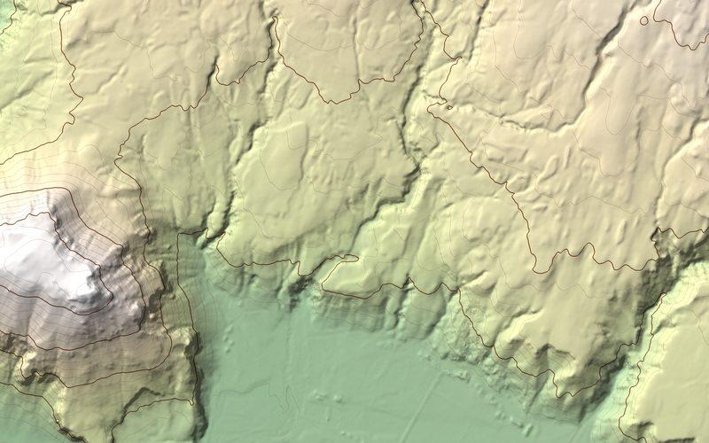
Skógafoss
The Skógá drops 60 metres over a former sea cliff onto the coastal plain at Skógafoss, after a staircase of smaller falls in the gorge it has cut above.
Option A: Freshwater
3.5 × 3.5 km · 12 to 476 m
QualityNo aerial photo is available here.Open the model
IcelandJökulsárgljúfur, north-east Iceland
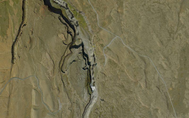
Dettifoss
The Jökulsá á Fjöllum drops into the canyon it has cut: Selfoss upstream, the 44-metre fall of Dettifoss, and the gorge running north towards Hafragilsfoss.
Option A: Freshwater
4 × 4.5 km · 198 to 384 m
QualityFine elevation survey and a clear aerial photo.Open the model
FranceVal d'Allier, south of Moulins, France
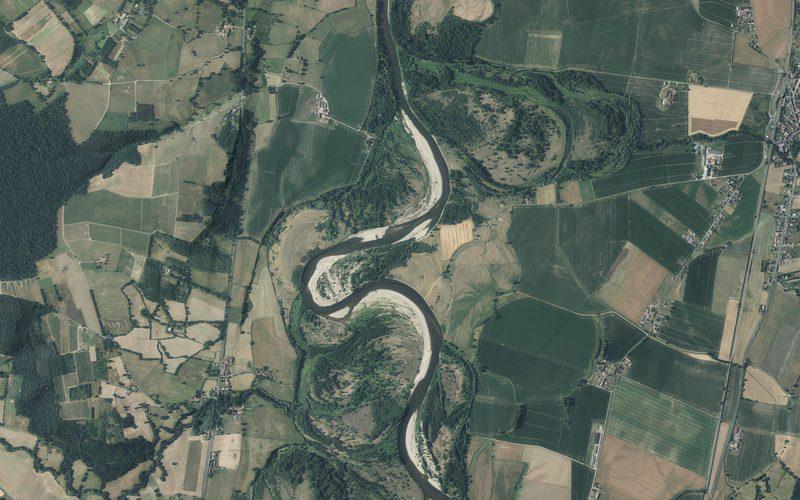
Meanders of the Allier
A river still free to move: tight meander loops on the Allier near Châtel-de-Neuvre, with pale point bars on the inside of each bend, cut banks on the outside, and the curved scars of older channels across the floodplain.
Option A: Freshwater
5 × 5 km · 213 to 282 m
QualityFine elevation survey and a clear aerial photo.Open the model
Volcanoes
People in the landscape
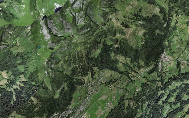
SwitzerlandVaud Alps, Switzerland
Leysin ski area
The village and the slopes above it: Berneuse, the Tour d'Aï and Tour de Mayen, and east across Brion and Les Fers to Solepraz.
Option C: Extreme environments
6 × 6 km · 612 to 2,331 m
QualityFine elevation survey and a clear aerial photo.Open the model
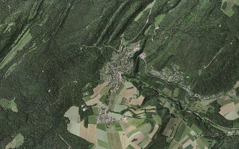
SwitzerlandFoot of the Jura, Vaud, Switzerland
St-George
The village of St-George on its shelf at the foot of the Vaud Jura, with Mont Chaubert beside it and the forested slope behind, where the road climbs towards the Col du Marchairuz.
4 × 4 km · 739 to 1,358 m
QualityFine elevation survey and a clear aerial photo.Open the model
Fieldwork sites
How they are made
Each model starts from a national elevation survey: IGN LiDAR HD in France, swissALTI3D in Switzerland, the USGS 3D Elevation Program in the United States. The tiles for a chosen rectangle are merged, then turned into a surface with no vertical exaggeration. The shading comes from the full survey, so gullies, moraines and crevasses show even where the shape itself is simplified. Each model's page says how fine its survey is.
The method follows Laurent Moreau's Alpine Environments project at the International School of Geneva, scripted so a new site needs only a rectangle on the map.
How big can a model be?
Every model has the same budget of points and pixels, so a bigger area loads just as fast but shows less detail per kilometre. The best results come from a square 4 to 8 km across. Beyond about 30 km the fine survey no longer helps, and at true scale even high mountains start to look flat.
| Square, side | Good for | Shape drawn every | One photo pixel |
|---|---|---|---|
| 2 km | One landform: a cirque, a gorge, a landslide scar, a village | 3.5 m | 0.35 m |
| 4 to 8 km | The best balance: a whole glacier, a ski area, a village in its setting | 7 to 14 m | 0.7 to 1.4 m |
| 10 to 15 km | A valley, a group of mesas, a small volcano | 17 to 26 m | 1.7 to 2.6 m |
| 20 to 30 km | A large volcano, a delta, a mountain massif. The practical limit | 34 to 51 m | 3.5 to 5 m |
Figures are for large screens; phones get half the shape detail and a photo half as sharp. An area need not be square: a long valley can be a rectangle with the same budget.
Which countries make the best models
A model needs an open elevation survey, and it looks best with an open aerial photo over it. Countries differ a great deal in what they publish, so where an example is matters as much as what it is. Each verdict comes with circles for the best quality score a model in that country can reach, and a note on what can pull it down.
Ready now, good quality anywhereCan be built today
A survey and a clear photo cover the whole country. Any landform here should score 4 or 5.
| Country | Verdict | Survey and photo | Good for |
|---|---|---|---|
| France | Excellent | Survey: 0.5 mPhoto: Whole country | Alpine and Pyrenean glaciers and cirques, river landforms, coasts, the Auvergne volcanoes |
| Switzerland | Excellent | Survey: 0.5 mPhoto: Whole country, and a strip past the border | Glaciers, pyramidal peaks, glacial troughs, lakes and deltas |
| Austria | Excellent | Survey: 1 mPhoto: Whole country | Alpine glaciers, glacial troughs and ribbon lakes |
| Svalbard | Excellent Some flights are dark, which costs a point | Survey: 2 mPhoto: Whole archipelago | Periglacial landscapes: pingos, patterned ground, permafrost terrain |
| Spain | Very good The 5 m survey costs a point; a finer 2 m one exists only as manual downloads | Survey: 5 mPhoto: Whole country | Semi-arid landforms: ramblas and badlands; coasts; the Canary Island volcanoes |
| Japan | Very good The 5 m survey costs a point; more where only 10 m exists | Survey: 5 m for much of the country, 10 m elsewherePhoto: Whole country | Deltas and cities on them, volcanoes, tectonic landscapes |
Ready now, but it depends whereCan be built today
A model can be made today, and how good it is depends on the exact place. Worth a check before choosing.
| Country | Verdict | Survey and photo | Good for |
|---|---|---|---|
| USA | Good where LiDAR exists Only 2 or 3 where there is no LiDAR, as at Monument Valley | Survey: 1 m where LiDAR has been flown, 10 m elsewherePhoto: The lower 48 states; not Alaska | Deserts, canyons, dunes, volcanoes, big rivers |
| Iceland | Good inside the photo area 3 outside the photo area, as at Skógafoss | Survey: 2 mPhoto: The north-east and a patch of the south-east (November 2026) | Glacier snouts and moraines in the south-east, canyons and waterfalls in the north-east |
| England | Shape only Shape, map and contours only | Survey: 1 mPhoto: None that is free to use | Glaciated uplands, rivers and coasts where the shape matters more than the photo |
Could be added, but it depends whereNot set up yet
Worth adding for particular places. Check the exact site before promising a model.
| Country | Verdict | Survey and photo | Good for |
|---|---|---|---|
| Germany | Good where the state is open North Rhine-Westphalia and Bavaria are open; other states vary | Survey: 1 m, published state by statePhoto: State by state | The Rhine gorge, river landforms, the Bavarian Alps |
| Italy | Mixed Coarse outside the LiDAR areas | Survey: 10 m nationally; 1 m for coasts, rivers and some regionsPhoto: A national photo from 2012; newer ones region by region | Volcanoes, the Dolomites, deltas |
| Norway | Shape only Shape and an excellent open map only | Survey: 1 m or finerPhoto: The national photo service needs a login | Fjords and glacial troughs |
| Greenland | Shape only Shape only | Survey: 2 mPhoto: None; satellite images only | Ice sheet margins and outlet glaciers |
| Ireland | Weak Most of the country has no fine survey | Survey: 1 to 2 m in patchesPhoto: None that is free to use | Only places inside a surveyed patch |
Coarse data onlyNot set up yet
No open national survey or photo. Only large features come out well: a whole valley, an erg, a delta, a volcano.
| Country | Verdict | Survey and photo | Good for |
|---|---|---|---|
| Morocco | Weak | Survey: 30 m (global)Photo: None; 10 m satellite images | High Atlas valleys, large dune fields |
| China, India, Nepal, Bangladesh, the Philippines, Nigeria, Niger, Kenya, Ethiopia | Weak | Survey: 30 m (global)Photo: None; 10 m satellite images | Large features only: Himalayan valleys, big deltas, rift valleys |
Any country not listed needs checking first. The scores assume a tight area of a few kilometres; a large area costs a point anywhere.
What the quality score means
Each model is scored out of 5 by the same rules. Five means a fine elevation survey (2 m or better), a clear aerial photo and a tight area. A model loses two points where no aerial photo is available, one where part of the photo is in shadow, two where most of the area has only coarse elevation data, and one where the area is large enough to cost detail close up. The line under each score says which applied.
For teachers
Every model has an "Embed this model" button, with what to paste into Notion or Google Sites. Teachers with a Revise account can also put their own numbered labels on a model, each with text and links, and share the labelled copy with a class by link or embed. Add your own labels